Csorvás
 |
It covers an area of 90.18 km² and has a population of 4,871 people (2015).
The town of Csorvás is situated in Békés county, next to the main road No. 47. The first written record of the town is from 1217 but Csorvás became an independent settlement in 1857. The town has a symmetrical lay-out and has been rebuilt three times during its history. During the excavations, archeologists found church ruins from the age of the Árpáds.
The development of the town is founded on the talent and diligence of its Hungarian, Slovak and Romanian inhabitants. At the time, agriculture was the primary industry and the settlement’s output was predominantly wheat, maize and pig and cattle breeding.
With the arrival of the Nagyvárad-Fiume railway line in 1871, Csorvás became the main transport centre for agricultural produce. By 1970, Csorvás was a large village with sufficiently developed infrastructure and canalization to ensure water and natural gas were readily available to inhabitants of the whole area.
The town contains the “Unified Social Home”, a full scale specialized service for the old and infirm. Subsidized housing for the towns’ young people is also available.
Csorvás now has a modern developed town centre, as well as three churches and a chapel around Szabadság Square. The town also contains a big park decorated with pieces of fine art. The outskirts of the town are designated “greenbelt” areas where the “Transylvanian Hérics” (a protected flower) thrives.
Visitors are more than welcome to our festivals. In March we organize the “International Folklore Meeting” to celebrate the marriage of Béla Bartók's parents in our Roman Catholic church (Béla Bartók is a Hungarian composer, famous for composing folk music). In June we organize the “Harvest Race” and demonstrate the traditional threshing process. In addition, the International Wedding Gastronomical Days is held at the end of July and the dedication festival is on the first Sunday after 15 October.
Our 15 representatives, 21 NGOs (Non- Governmental Organization) and 5667 Csorvás residents do a substantial amount to develop the area. As of July 1, 2005, Csorvás is officially the youngest town in Békés county.
Map - Csorvás
Map
Country - Hungary
 |
 |
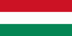
| Flag of Hungary | |
The territory of present-day Hungary has for centuries been a crossroads for various peoples, including Celts, Romans, Germanic tribes, Huns, West Slavs and the Avars. The foundation of the Hungarian state was established in the late 9th century AD with the conquest of the Carpathian Basin by Hungarian grand prince Árpád. His great-grandson Stephen I ascended the throne in 1000, converting his realm to a Christian kingdom. By the 12th century, Hungary became a regional power, reaching its cultural and political height in the 15th century. Following the Battle of Mohács in 1526, it was partially occupied by the Ottoman Empire (1541–1699). Hungary came under Habsburg rule at the turn of the 18th century, later joining with the Austrian Empire to form Austria-Hungary, a major power into the early 20th century.
Currency / Language
| ISO | Currency | Symbol | Significant figures |
|---|---|---|---|
| HUF | Hungarian forint | Ft | 2 |
| ISO | Language |
|---|---|
| HU | Hungarian language |


